If you purchase using links on our site we may earn an affiliate commission, but at no extra cost to you.
📡 BACKCOUNTRY PULSEBreaking — March 2026
New Garmin data confirms 3,000+ inReach SOS activations in 2025 — 1 in 3, triggered helicopter dispatch. Here’s what it means for backcountry users, the rise of satellite SOS, and the volunteer SAR teams who respond.
Satellite SOS technology is fundamentally changing how backcountry emergencies are handled — and Garmin’s newly released 2025 inReach SOS Year in Review confirms what search and rescue coordinators have been saying for years. More than 3,000 SOS activations were logged globally last year — and for the first time, a clear picture of how two-way messaging is reshaping rescue operations has emerged.
The numbers tell a story of technology doing its job — and of a volunteer rescue infrastructure being asked to absorb more than it was designed to carry as satellite SOS devices proliferate.
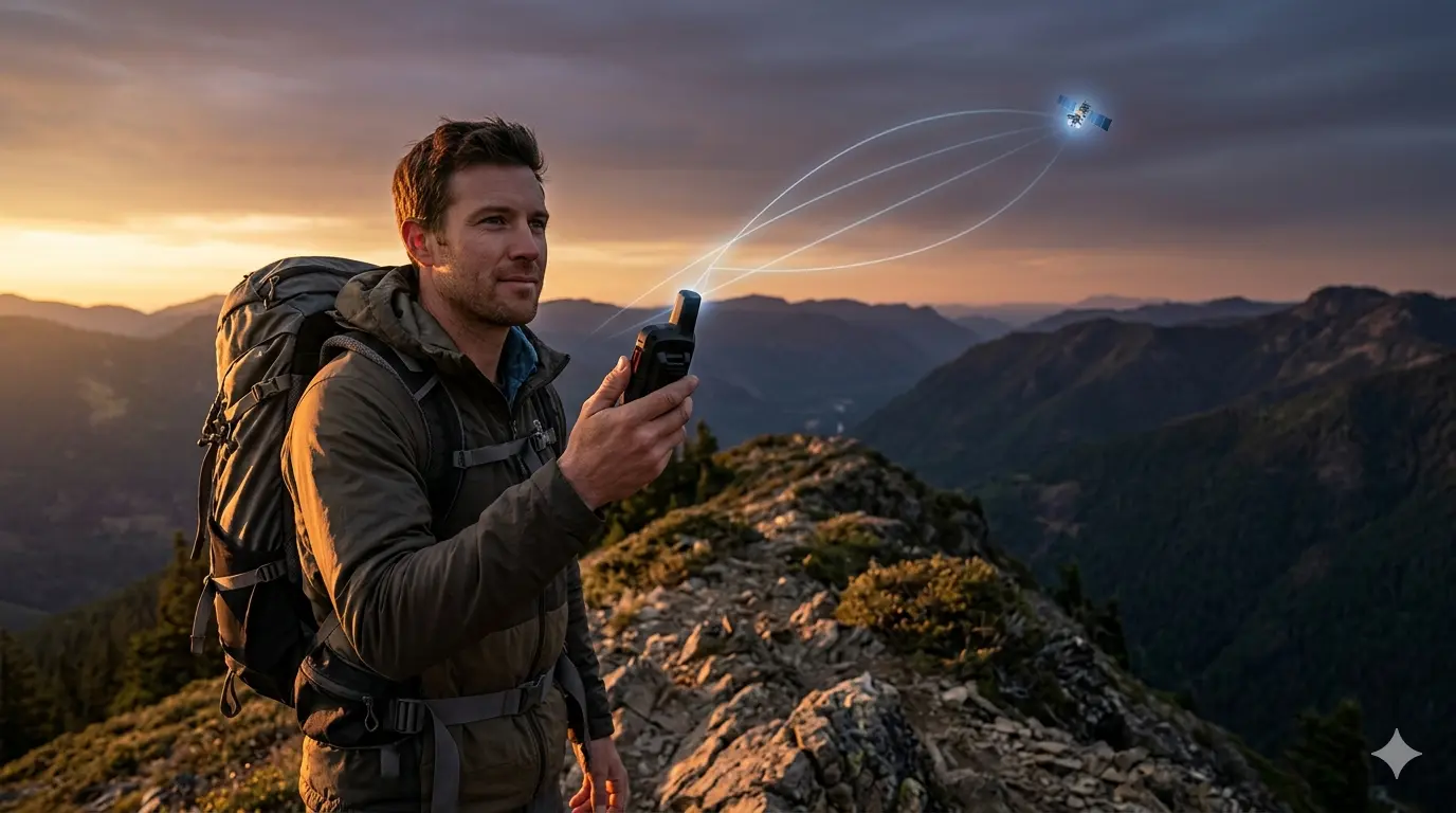
The satellite SOS button interface. Two-way messaging resolved 12% of 2025 incidents without boots on ground.
3,000+Satellite SOS incidents globally in 2025Garmin, Feb. 25, 2026
12%Resolved via two-way messaging — no boots on groundGarmin, Feb. 25, 2026
~1 in 3Satellite SOS incidents triggered helicopter dispatchGarmin, Feb. 25, 2026
Top 10Work-related SOS enters top 10 for first time in 2025Garmin, Feb. 25, 2026
✓ OTL Field Report | 20+ Years Northern Michigan Backcountry | Garmin-Verified 2025 Data
📊 The Surge by the Numbers: Satellite SOS in 2025
Garmin published its 2025 inReach SOS Year in Review on February 25, 2026 — the most detailed look yet at how satellite SOS technology is being used in the field.
For the first time, the company confirmed a hard annual total: more than 3,000 satellite SOS incident messages received in a single calendar year. Hiking and backpacking remained the top activity category, with trail and mountain incidents notably up from 2024.
Injuries led as the top cause of activations, followed by motor vehicle accidents and a rising trend of medical emergencies including altitude sickness and cardiac events. Boating displaced hunting as the sixth-largest category, and work-related satellite SOS activations broke into the top 10 for the first time.
📋 2025 SOS Activity Breakdown — What Changed
Activity Category
2025 Trend
Notes
Hiking & Backpacking
↑ Up
Top category; trail and mountain incidents increased from 2024
Driving & Motorcycling
→ Stable
Remained in top 5 consistent with prior years
Climbing & Mountaineering
↑ Up
Included in overall trail/mountain category increase
Boating
↑ Up
Replaced hunting as 6th-largest incident category
Sailing
↑ Up
Marine identified as a growing segment
Work-Related (Professional)
★ New Entry
First appearance in top 10; organizations equipping field workers
Source: All data from the official 2025 Garmin inReach SOS Year in Review, published February 25, 2026. Global inReach data only — does not include SPOT, Zoleo, or Apple Emergency SOS.
📡 How Satellite SOS Tech Changes the Equation
The headline stat from this year’s report is the 12% self-rescue rate — satellite SOS incidents resolved entirely through two-way messaging, with no helicopter, ground team, or ambulance required.
Garmin fēnix 8 Pro Series: first smartwatch with built-in satellite SOS capability.
Garmin Response coordinators guided distressed users through de-escalation, navigation corrections, and basic medical triage using satellite text alone. In real terms, that is more than 360 satellite SOS incidents in 2025 where the right message kept full-scale rescue from activating.
The 2025 inReach product rollout accelerated this capability considerably. The fēnix 8 Pro Series became the first Garmin smartwatch to carry inReach satellite SOS technology. The inReach Mini 3 Plus and GPSMAP H1i Plus added photo and voice messaging via satellite.
🛰️ The 2025 inReach Product Expansion
fēnix 8 Pro Series: First Garmin smartwatch with inReach satellite SOS capability. Puts emergency communication on the wrist of users who never previously carried a dedicated device.
inReach Mini 3 Plus: Adds color touchscreen, photo messaging, and voice via satellite — including during an active satellite SOS event. Garmin Response coordinators can now see and hear the scene in real time.
GPSMAP H1i Plus: Same inReach Plus capability in a rugged handheld form factor for extended backcountry use.
OTL Field Note: The ability to send a photo of your location, injury, or terrain during an active satellite SOS fundamentally changes remote triage. A coordinator who can see the scene makes faster, better decisions. Two-way messaging is no longer a fallback — it is an active rescue tool.
🌲 The New Reality for SAR Teams
For all the efficiency gains the 12% self-rescue rate represents, SAR coordinators across the country are navigating a more complicated picture on the ground. Volume is up, driven largely by the proliferation of satellite SOS devices.
Volunteer SAR teams respond to rising satellite SOS activations across the country.
Medical incidents are increasing year over year — a trend Garmin’s own report flags explicitly. And roughly one in three satellite SOS activations still results in helicopter dispatch, one of the most resource-intensive emergency responses in existence.
The broader satellite SOS ecosystem has also expanded far beyond inReach. Apple’s Emergency SOS via satellite is now standard on every new iPhone, placing a distress button in the pockets of millions of users who have received no training on when or how to use it. SPOT, Zoleo, and a growing category of Android satellite messaging devices are adding millions more access points to a system staffed largely by a mix of volunteer and underfunded county SAR teams.
Backcountry regions across the upper Midwest — including the Manistee National Forest and the Pere Marquette River corridor — operate under the same volunteer SAR frameworks as the rest of the country. Federal staffing cuts to the U.S. Forest Service, well documented through 2025 and into 2026, have reduced the agency personnel available to support those volunteer networks. The math is tightening as satellite SOS adoption accelerates.
⚠️ The Compounding Pressure
Volume is rising: 3,000+ inReach activations is Garmin’s platform alone. SPOT, Zoleo, and Apple Emergency SOS add millions more potential satellite SOS activation points across the same volunteer SAR infrastructure.
Medical incidents are trending up: Altitude sickness, cardiac events, and gastrointestinal emergencies are increasing year over year — these require genuine medical response, not navigation coaching.
USFS staffing is shrinking: Federal budget proposals for FY2026 target significant cuts to USFS non-fire programs. Fewer agency personnel means less support for volunteer SAR networks operating in National Forest terrain.
New device users lack context: The consumer carrying a fēnix 8 or iPhone with satellite SOS is not the same user profile as someone who bought a dedicated device and read the manual. Training gaps are widening as the user base expands.
🎯 What Backcountry Users Need to Know About Satellite SOS
Owning a satellite SOS device is not the same as knowing how to use one responsibly. The 12% self-rescue figure reflects users who understand how to stay calm, provide coordinates, describe their situation clearly, and follow dispatcher guidance.
For the millions of new users reaching for satellite SOS via a consumer smartwatch or smartphone, that baseline often is not there. The device does its job. The user has to do theirs.
📋 OTL Field Guidance: Using Your Satellite SOS Device Responsibly
Two-Way Messaging First
Message before you activate satellite SOS. If you are not in immediate danger, send a detailed status message to your emergency contact or Garmin Response first. Dispatchers can often triage remotely and avoid a full response.
Lead with coordinates. GPS coordinates are the most actionable piece of information a dispatcher can receive. Everything else is context — coordinates are action.
Be specific, not vague. “I think I twisted my ankle” and “I cannot weight-bear and have 8 miles of trail between me and the trailhead” generate completely different responses.
When Satellite SOS Is Appropriate
Injury that prevents self-extraction from the backcountry
Medical emergency with worsening condition and no cell coverage
Life-threatening situation where waiting for improvement is not viable
Third-party emergency where the person cannot activate themselves
OTL Field Note: The people coming for you in a backcountry emergency are largely volunteers. They leave work, leave family, and put themselves at risk to help strangers.
Reserve the full satellite SOS for genuine emergencies. Use two-way messaging for everything else. That 12% self-rescue rate is proof the messaging system works — use it first.
OTL editorial guidance — not a substitute for formal wilderness first aid training.
🌲 OTL Field Perspective
Northern Michigan’s backcountry — the Manistee National Forest, the Pere Marquette corridor, the Lake Michigan shoreline — runs on the same volunteer SAR infrastructure as the rest of the country. I’ve run these trails and rivers long enough to know that the people who will come for you in an emergency aren’t professionals drawing a salary. They’re your neighbors.
The Garmin data reflects what those neighbors are dealing with at scale as satellite SOS adoption grows. Carry your communicator. Learn how to use it.
When you press that satellite SOS button, you’re pulling on a rope that has real people on the other end. For the full backcountry kit, see our best solo camping gear guide.
❓ Satellite SOS FAQ
What does the Garmin 2025 SOS report actually show?
Garmin’s 2025 inReach SOS Year in Review — published February 25, 2026 — confirmed more than 3,000 satellite SOS incident messages received globally in 2025. Hiking and backpacking generated the most activations. Trail and mountain incidents were up year over year.
Work-related satellite SOS incidents entered the top 10 for the first time, reflecting professional organizations equipping field workers with satellite communicators. The standout finding: over 12% of incidents were resolved entirely through two-way satellite messaging, with no emergency resources dispatched.
What is the difference between two-way messaging and satellite SOS?
Two-way messaging on devices like the Garmin inReach allows you to exchange text messages with your emergency contact or Garmin Response coordinators — without triggering a full emergency rescue response. Satellite SOS activates a full emergency response: Garmin Response contacts local search and rescue, and resources including helicopters, ambulances, and ground teams may be dispatched.
Two-way messaging is for non-life-threatening situations where you need guidance, status check-ins, or remote triage. Satellite SOS is for genuine emergencies where you need physical rescue.
Does Apple Emergency SOS via satellite work the same as Garmin inReach?
No — they are different satellite SOS systems with different capabilities. Apple Emergency SOS via satellite connects you directly to emergency services and uses a guided questionnaire to relay your situation and location. It does not support the same two-way conversational messaging that the inReach platform uses with Garmin Response coordinators.
The inReach system allows back-and-forth dialogue, photo sharing (on newer devices), and remote triage in a way Apple’s current implementation does not. Both can activate emergency response, but the inReach’s two-way capability is what enables that 12% self-rescue rate.
What satellite SOS device is best for Northern Michigan backcountry?
For most Northern Michigan backcountry users — Manistee National Forest, UP destinations, Pere Marquette corridor — the Garmin inReach Mini 3, is the current benchmark for size, battery life, and two-way satellite SOS capability. The Mini 3 Plus adds photo and voice messaging via satellite.
If you already own an iPhone 14 or newer, Apple Emergency SOS is a valid safety net for day hikes with cell coverage gaps, but it should not replace a dedicated satellite SOS device for multi-day backcountry trips. Our full inReach Mini 2 vs. Mini 3 comparison breaks down both devices in detail.
As satellite SOS technology moves from niche gear to mass-market consumer products, the emergency infrastructure behind it is absorbing a volume it was never built to carry. The 12% self-rescue rate shows that two-way messaging works. Use it before you use the satellite SOS button.
Before any backcountry expedition, make sure your safety fundamentals are solid — our iPhone 17 vs inReach satellite guide covers the full field loadout and answers the top connectivity questions.
The satellite SOS button is a lifeline. Use it like one. 🛰️🌲
Data sourced from the official 2025 Garmin inReach SOS Year in Review, published February 25, 2026. All statistics are Garmin-reported global figures reflecting inReach platform activations only.
OutdoorTechLab.com — Field reporting anchored in 20+ years of Northern Michigan backcountry experience. OTL editorial guidance does not constitute official SAR protocol or wilderness first aid advice.
Gear mentioned in this report — live pricing via Amazon
JC Courtland, Outdoor Gear Expert Courtland is the founder of Outdoor Tech Lab with 20+ years of backcountry experience and formal wilderness safety training. Based in Ludington, MI, he personally tests all gear featured on the site to provide honest, real-world insights for outdoor enthusiasts. JC holds certifications in Wilderness First Aid and has professional experience as a satellite communications specialist.
To provide the best experiences, we use technologies like cookies to store and/or access device information. Consenting to these technologies will allow us to process data such as browsing behavior or unique IDs on this site. Not consenting or withdrawing consent, may adversely affect certain features and functions.
Functional
Always active
The technical storage or access is strictly necessary for the legitimate purpose of enabling the use of a specific service explicitly requested by the subscriber or user, or for the sole purpose of carrying out the transmission of a communication over an electronic communications network.
Preferences
The technical storage or access is necessary for the legitimate purpose of storing preferences that are not requested by the subscriber or user.
Statistics
The technical storage or access that is used exclusively for statistical purposes.The technical storage or access that is used exclusively for anonymous statistical purposes. Without a subpoena, voluntary compliance on the part of your Internet Service Provider, or additional records from a third party, information stored or retrieved for this purpose alone cannot usually be used to identify you.
Marketing
The technical storage or access is required to create user profiles to send advertising, or to track the user on a website or across several websites for similar marketing purposes.


Leave a Reply