
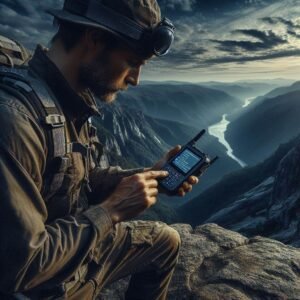
The Essential Tech Trio for Backcountry Safety in 2025: PLB, Sat Messenger, and Advanced Weather Tools
Why Your Life Could Depend on These Devices
The call of the backcountry is irresistible to many outdoor enthusiasts—pristine wilderness, untouched landscapes, and the profound sense of solitude that comes with venturing where cell service fades into oblivion.
Yet this same isolation creates real risks that claim lives every year.
While nothing replaces solid skills, detailed planning, and sound judgment, modern technology offers a critical safety net that can literally mean the difference between life and death when adventures go sideways.
In this latest OTL guide, we’ll explore the three essential pieces of technology every serious backcountry traveler should consider in 2025:
- Personal Locator Beacons (PLBs): Your emergency SOS lifeline
- Satellite Messengers: Your communication hub beyond cell service
- Advanced Weather Tools: Your early warning system against nature’s deadliest threats
Together, these form what we call the “Essential Tech Trio” for modern backcountry safety—covering emergency response, communication, and environmental awareness. Let’s dive deep into each component.
Pillar 1: Personal Locator Beacons (PLBs) — The Ultimate SOS Button

What Are PLBs and How Do They Work?
Personal Locator Beacons represent the most reliable form of emergency signaling technology available to civilians. These compact devices operate on the international COSPAS-SARSAT satellite network—the same system used by aircraft and maritime emergency beacons.
When activated in an emergency:
- Your PLB transmits a powerful 406 MHz distress signal carrying your unique identifier and precise GPS location to orbiting satellites
- These satellites relay your signal to ground stations around the world
- The signal is forwarded directly to search and rescue authorities (not a private company)
- Many PLBs also emit a secondary 121.5 MHz homing signal to help rescuers pinpoint your exact position as they close in
The PLB Advantage in 2025
Pros:
- Unmatched reliability: The dedicated COSPAS-SARSAT network provides truly global coverage with exceptionally high signal reliability
- No subscription required: Once purchased and properly registered, there are no ongoing fees
- Remarkable battery life: Typically 5-10 years shelf life and 24+ hours of continuous transmission when activated
- Simplicity: One-button operation when every second counts
- Direct government response: Signals go straight to official search and rescue authorities
Cons:
- One-way communication only: You can’t receive confirmation that your signal was received
- Emergency-only device: Not designed for check-ins or routine communications
- No tracking features: Others can’t follow your progress remotely
Top PLB Options for 2025
- ACR ResQLink View: The gold standard combining compact size (4.52 oz), integrated digital display showing GPS coordinates, and buoyancy for water activities
- Ocean Signal rescueME PLB1: Ultra-compact (4.0 oz) with exceptional 7-year battery life
- McMurdo FastFind 220: Reliable performance in a streamlined package with global coverage
Key PLB Considerations
Before purchasing, evaluate:
- Registration requirements: All PLBs must be registered with your country’s authority (NOAA in the US)—this is free and connects your device to your emergency contact information
- GPS capability: Ensure your model includes GPS for faster location accuracy (most modern units do)
- Buoyancy: Essential for paddling, fishing, or water-based activities
- Battery replacement: Most require factory service for battery replacement (typically every 5-7 years)
- Testing procedures: Understand how to properly test your device without triggering a false alarm
Pillar 2: Satellite Messengers — Your Communication Lifeline
Beyond SOS: Two-Way Communication When It Matters
While PLBs excel at pure emergency signaling, satellite messengers bring versatile two-way communication to the backcountry.
These devices connect to commercial satellite networks (primarily Iridium or Globalstar) to provide text messaging, tracking, weather updates, and SOS capabilities beyond cellular coverage.
Why Two-Way Communication Changes Everything
The ability to send and receive messages transforms your safety profile by enabling:
- Detailed explanation of your emergency situation to rescuers
- Confirmation that help is on the way
- Non-emergency assistance for minor issues
- Regular check-ins with family and contacts
- Critical updates about changing plans
- Coordination with other group members
The Satellite Messenger Landscape in 2025
Pros:
- Two-way messaging: Send and receive texts anywhere on the planet
- Context for emergencies: Explain your situation rather than just signaling distress
- Location tracking: Share your journey with selected contacts in real-time
- Weather forecasts: Access vital weather information in the field
- Versatility: Use for both emergencies and convenience communication
Cons:
- Subscription required: Monthly or annual plans ranging from $12-50+ depending on features
- Battery management: Requires regular charging (though battery life has improved significantly)
- Network limitations: Coverage can vary by network and extreme terrain
- Potential technical complexity: Some models require smartphone pairing
Leading Satellite Messengers in 2025
- Garmin inReach Mini 2: Ultra-compact (3.5 oz) powerhouse with up to 14 days battery life using the reliable Iridium network
- Garmin Messenger Plus: Newest model featuring photo messaging, voice notes, and reverse charging for your smartphone
- Zoleo Satellite Communicator: Budget-friendly option with flexible subscription plans and dedicated phone number
- Bivy Stick: Ultralight design with simplified interface and competitive pricing
- SPOT X: Two-way messaging with physical keyboard and Globalstar network (note: less complete global coverage)
Selecting the Right Satellite Messenger
Consider these factors when choosing:
- Network coverage: Iridium offers more complete global coverage than Globalstar
- Interface preferences: Built-in screen and buttons vs. smartphone app control
- Subscription structure: Message limits, SOS inclusion, tracking intervals, suspension options during off-seasons
- Battery life: Both standby time and active use time
- Weight and size: Critical for ultralight adventures
- Additional features: Weather forecasts, navigation capabilities, smartphone charging
PLB or Satellite Messenger? Why Not Both?
For those venturing into truly remote or high-risk environments, carrying both a PLB and satellite messenger provides the ultimate redundancy:
- PLB: Your fail-safe, no-subscription emergency beacon with the most reliable network
- Satellite Messenger: Your versatile communication tool for regular updates and non-life-threatening situations
For most recreational backcountry users, a quality satellite messenger with SOS functionality provides the best balance of features and value—though a PLB’s simplicity and subscription-free operation remain compelling.
Pillar 3: Advanced Weather Tools — Your Environmental Intelligence System
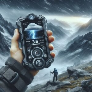
Why Weather Awareness Is Critical
Weather remains one of the deadliest forces in the backcountry, capable of transforming a routine outing into a survival situation within hours.
Standard weather forecasts often fail to capture the microclimate effects in mountains, canyons, and large bodies of water where conditions change dramatically with elevation and terrain.
In 2025, advanced weather tools provide the environmental intelligence needed to make life-saving decisions before conditions deteriorate.
Essential Weather Technologies for the Backcountry
1. Barometric Pressure Monitoring
The single most valuable weather indicator in the field is barometric pressure. A falling barometer often signals approaching storms, while rising pressure typically indicates improving conditions.
Key options include:
- Dedicated Weather Meters: Kestrel devices (2500, 3500, 5500) provide professional-grade measurements of pressure, temperature, humidity, and wind
- ABC Watches: Advanced outdoor watches from Garmin (Fenix/Instinct series), Suunto (Core/9), and Coros (Vertix/Apex) incorporate altimeter, barometer, and compass functions with pressure trend indicators
- Smartphone Sensors: Many modern phones include barometric sensors that work with specialized apps, though these require battery management
2. Satellite-Based Weather Forecasts
Your satellite messenger can double as a weather forecast tool:
- Garmin inReach/Messenger Series: Basic and premium weather forecasts available on-demand
- Zoleo Weather: Access to detailed forecasts through the companion app
- Bivy Stick Weather: Point-specific forecasting available with subscription
3. Pre-Trip Planning Tools (with offline capability)
Before losing connectivity, leverage these specialized resources:
- Windy.com: Outstanding visualization of multiple forecast models (ECMWF, GFS) with downloadable offline data
- Mountain-Forecast.com: Elevation-specific forecasts critical for mountainous terrain
- NWS Point Forecasts: Latitude/longitude specific forecasts from the National Weather Service
- Specialty Apps: Gaia GPS, OnX, and similar mapping apps now include downloadable weather overlays
Interpreting Weather Data in the Field
Understanding what the data means is as important as having access to it:
- Pressure Drops: A drop of 0.18 inHg (6 hPa) or more over three hours often indicates an approaching storm system
- Rate of Change: Rapid pressure changes (either direction) typically signal more severe weather
- Elevation Effects: Remember to normalize pressure readings for elevation when comparing to forecasts
- Visual Confirmation: Correlate instrument readings with cloud formations, wind shifts, and other observable conditions
The Power of Integration: How the Tech Trio Works Together
The true power of the Essential Tech Trio emerges when these technologies work in concert. Consider these real-world scenarios:
Scenario 1: The Developing Emergency
You’re on day three of a five-day backcountry trip when your hiking partner sustains a potentially serious leg injury.
- Weather Tool: Your ABC watch shows stable pressure, indicating no immediate weather concerns
- Satellite Messenger: You message your emergency contact explaining the situation, send photos of the injury, and request detailed first aid advice
- Decision Point: Based on the stable weather and remote support, you decide to splint the injury and slowly hike out rather than trigger an expensive rescue
- Ongoing Communication: You provide regular updates on your progress via satellite messenger
- PLB Backup: Your PLB remains ready should the situation deteriorate
Scenario 2: The Weather Emergency
You’re approaching an alpine pass when your barometer shows a dramatic pressure drop.
- Weather Tool: Your barometric watch alarms with a rapid pressure decrease
- Satellite Messenger: You request a detailed weather forecast, confirming a severe storm approaching
- Decision Point: You message your emergency contacts about your change of plans and decision to descend immediately to safer terrain
- Continuous Monitoring: You track the storm’s development via your weather tools while using your satellite messenger to navigate to the nearest emergency shelter
- PLB Readiness: Should conditions become life-threatening, your PLB remains your last-resort option

Beyond Technology: The Human Elements of Backcountry Safety
While this guide focuses on technology, we must emphasize that these devices supplement—never replace—the following essentials:
- Navigation Skills: Proficiency with map and compass as backup to GPS
- First Aid Training: Wilderness-specific medical training and appropriate supplies
- Trip Planning: Detailed route planning and contingency options
- Communication Protocol: Clear check-in schedules and emergency procedures with contacts
- Proper Equipment: Clothing, shelter, food, and gear appropriate for conditions
- Risk Assessment Skills: The judgment to turn back when necessary
Making Your Investment in Backcountry Safety
The complete Essential Tech Trio represents a significant investment—potentially $700-1,000 for quality devices plus subscription costs for satellite services.
However, when weighed against rescue costs (often $10,000+) or the incalculable value of human life, these technologies offer remarkable value.
Consider this progressive approach to building your backcountry safety system:
- Starting Point: Begin with a quality satellite messenger with SOS functionality
- Next Addition: Add advanced weather monitoring (often most economical via an ABC watch)
- Complete System: Add a PLB for ultimate redundancy in high-risk scenarios
Peace of Mind in the Wild
The backcountry offers irreplaceable experiences—solitude, challenge, and connection with pristine natural environments.
The Essential Tech Trio of PLB, satellite messenger, and advanced weather tools provides the security to enjoy these experiences with confidence.
As technology continues to evolve, the tools become smaller, more capable, and more integrated.
What remains constant is their potential to prevent emergencies through better information and to save lives when emergencies occur despite our best preparations.
What backcountry safety tech do you rely on? Have you had experiences where these devices made a critical difference? Share your stories in the comments below.
Additional Resources
- American Alpine Club Safety Resources
- National Weather Service Backcountry Forecasts
- Wilderness First Aid Courses Near You
Disclaimer: This article contains general information for educational purposes only.
Always research thoroughly, practice with your equipment before depending on it, and make conservative decisions in the backcountry.
Technology can fail—your judgment and preparation are your most important safety tools.
